Facts and Impact of 7-Magnitude Earthquake in Tibet

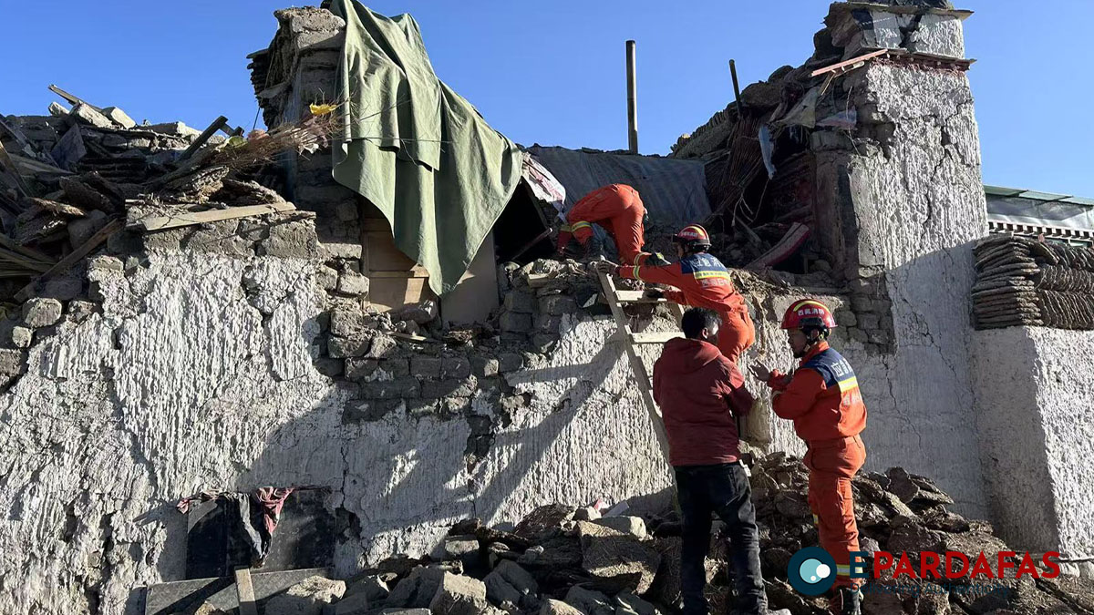
A powerful 7-magnitude earthquake struck Dingri County in Xigaze, southwest China’s Xizang Autonomous Region, at 9:05 a.m. on Tuesday. The quake, with a depth of 10 kilometers, caused significant damage and casualties. According to a press conference by Xinhua, as of 3:00 p.m., 95 people were confirmed dead, and 130 others were injured.
Dingri County lies on the northern slope of the Himalayas, bordering Nepal to the south. With an average altitude of 4,500 meters, it is located near the northern base camp of Mount Qomolangma (Mount Everest), the world’s highest peak. The epicenter was pinpointed in Tsogo Township, where approximately 6,900 residents live within a 20-kilometer radius, encompassing 27 villages.
Spanning 13,860 square kilometers, Dingri County comprises 13 townships and 180 administrative villages. It has a population of over 60,000, making it one of the most populous border counties in Xizang. The county seat is located 243 kilometers from the city of Xigaze.
Nearly 90 percent of Dingri County is part of the Qomolangma National Nature Reserve, a globally significant ecological area. The county also hosts the Qomolangma Atmospheric and Environmental Research Station, managed by the Chinese Academy of Sciences. Despite the earthquake, the station’s facilities remain in good condition.
Dingri experiences a plateau temperate semi-arid monsoon climate, with annual average temperatures ranging between 2.8 and 3.9 degrees Celsius. On the day of the earthquake, temperatures ranged from minus 18 degrees Celsius to zero, adding to the challenges faced by residents and rescue teams.
The earthquake highlights the vulnerability of this remote, ecologically sensitive region to seismic activity, as well as the resilience of its infrastructure and people amidst such natural disasters.
Input from Xinhua News


Comments