Rastriya Ekta Abhiyan Objects to China’s New Map Claiming Nepali Land
Rastriya Ekta Abhiyan has raised concerns over a new map released by China that depicts Nepal’s territory as part of Chinese land.
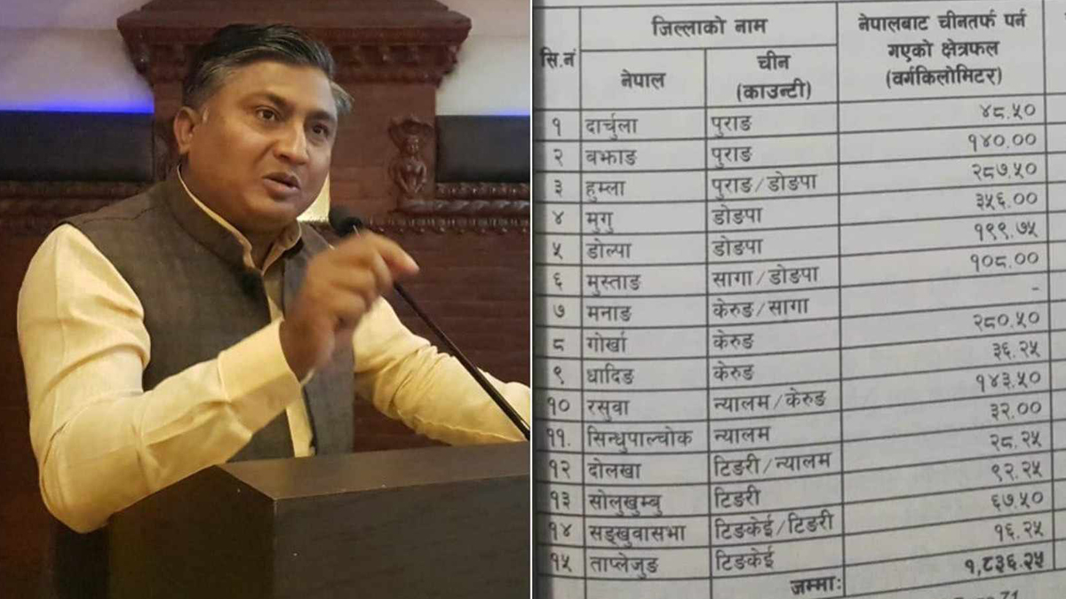
After some areas of Nepal’s Humla, Rasuwa, and Sindhupalchok districts were shown in Chinese territory on that map, protests are happening against China.
Binay Yadav, the Chairman of Rastriya Ekta Abhiyan, has pointed out that China’s map includes 6 hectares of land near the Bhagdare River in Humla and an additional 4 hectares near the Karnali River.
Furthermore, the map indicates the transfer of 6 hectares of land in Rasuwa, including the Sanjen River, Bhurjung River, and Jambukhola, to the Kerung region of Tibet. Additionally, it shows Kharane River in Sindhupalchok and 11 hectares of land in the Bhotekoshi region as part of the Nyalam region of Tibet.
Yadav expressed his opposition to China’s new map, highlighting that it includes areas like Rui and Teghagaun in Gorkha, which have been claimed as part of Tibet.
He also raised concerns that 9 hectares of land in Sankhuwasabha now fall within China’s territory, with Kamukhola, Arun Khola, and Sumzhang Khola also appearing as part of China on the map.
Yadav expressed his disappointment, noting that despite these territorial claims by China, government and political party leaders have remained silent on the issue of China asserting Nepal’s land as its own territory.


Comments